
Bowfell topographic map
Interactive map
Click on the map to display elevation.
About this map
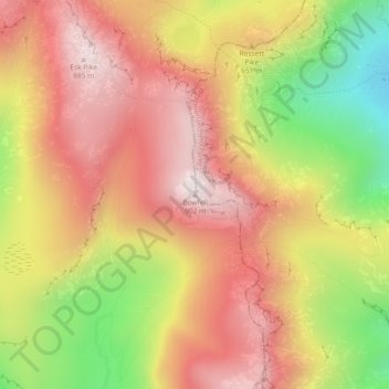
Name: Bowfell topographic map, elevation, terrain.
Average elevation: 1,939 ft
Minimum elevation: 587 ft
Maximum elevation: 2,904 ft
Other topographic maps
Click on a map to view its topography, its elevation and its terrain.
Wasdale
Reino Unido > Inglaterra > Copeland
Wasdale, Netherbeck Bridge, Wasdale, Copeland, Cumbria, North West England, Inglaterra, CA20 1EX, Reino Unido
Average elevation: 1,076 ft