
Bouarfa topographic map
Interactive map
Click on the map to display elevation.
About this map
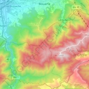
Name: Bouarfa topographic map, elevation, terrain.
Location: Bouarfa, Daïra Blida, Blida, RADP (36.36263 2.75095 36.46826 2.84405)
Average elevation: 2,474 ft
Minimum elevation: 308 ft
Maximum elevation: 5,308 ft