Cerro del Azufre topographic map
Interactive map
Click on the map to display elevation.
About this map
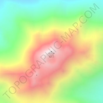
Name: Cerro del Azufre topographic map, elevation, terrain.
Average elevation: 17,566 ft
Minimum elevation: 15,988 ft
Maximum elevation: 19,140 ft

Click on the map to display elevation.
Name: Cerro del Azufre topographic map, elevation, terrain.
Average elevation: 17,566 ft
Minimum elevation: 15,988 ft
Maximum elevation: 19,140 ft