
Lago Uru Uru topographic map
Interactive map
Click on the map to display elevation.
About this map
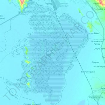
Name: Lago Uru Uru topographic map, elevation, terrain.
Location: Lago Uru Uru, Oruro, Provincia Cercado, ORU, Bolivia (-18.18545 -67.16976 -18.01067 -67.03438)
Average elevation: 12,159 ft
Minimum elevation: 12,129 ft
Maximum elevation: 13,173 ft