
Thank you for supporting this site ❤️
Make a donation
Make a donation
Gear up for your next adventure:
As an Amazon Associate, this site earns from qualifying purchases at no extra cost to you.
Pananggalon topographic map
Click on the map to display elevation.
Thank you for supporting this site ❤️
Make a donation
Make a donation
Gear up for your next adventure:
As an Amazon Associate, this site earns from qualifying purchases at no extra cost to you.
About this map
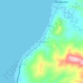
Name: Pananggalon topographic map, elevation, terrain.
Location: Pananggalon, Sarangani, Soccsksargen, Philippines (5.93157 125.25858 5.97157 125.29858)
Average elevation: 180 ft
Minimum elevation: 0 ft
Maximum elevation: 1,014 ft
Thank you for supporting this site ❤️
Make a donation
Make a donation
Gear up for your next adventure:
As an Amazon Associate, this site earns from qualifying purchases at no extra cost to you.