
石梨山村 topographic map
Interactive map
Click on the map to display elevation.
About this map
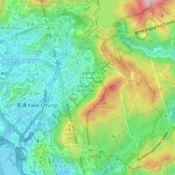
Name: 石梨山村 topographic map, elevation, terrain.
Location: 石梨山村, 葵涌, 葵青區, 新界, 香港, 中国 (22.34477 114.12168 22.38477 114.16168)
Average elevation: 456 ft
Minimum elevation: -13 ft
Maximum elevation: 1,385 ft
Other topographic maps
Click on a map to view its topography, its elevation and its terrain.