
Upper Sandusky topographic map
Interactive map
Click on the map to display elevation.
About this map
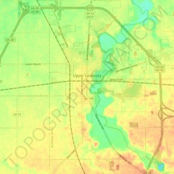
Name: Upper Sandusky topographic map, elevation, terrain.
Location: Upper Sandusky, Wyandot County, Ohio, 43351, United States (40.78210 -83.31179 40.86186 -83.21639)
Average elevation: 853 ft
Minimum elevation: 781 ft
Maximum elevation: 899 ft