
Thank you for supporting this site ❤️
Make a donation
Make a donation
Gear up for your next adventure:
As an Amazon Associate, this site earns from qualifying purchases at no extra cost to you.
Seceda topographic map
Click on the map to display elevation.
Thank you for supporting this site ❤️
Make a donation
Make a donation
Gear up for your next adventure:
As an Amazon Associate, this site earns from qualifying purchases at no extra cost to you.
About this map
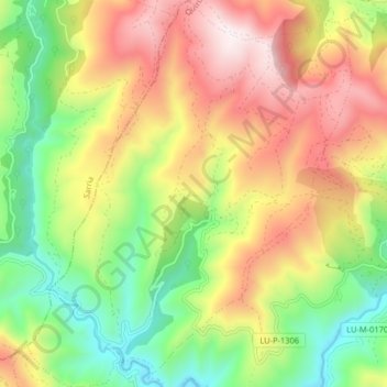
Name: Seceda topographic map, elevation, terrain.
Location: Seceda, Folgoso do Courel, Quiroga, Lugo, Galicia, Spain (42.59930 -7.25805 42.65868 -7.19025)
Average elevation: 2,989 ft
Minimum elevation: 1,506 ft
Maximum elevation: 4,754 ft
Thank you for supporting this site ❤️
Make a donation
Make a donation
Gear up for your next adventure:
As an Amazon Associate, this site earns from qualifying purchases at no extra cost to you.