
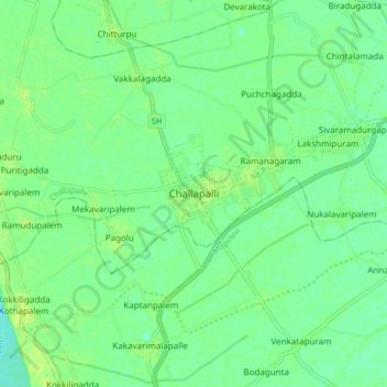
Challapalli topographic map
Interactive map
Click on the map to display elevation.
About this map
Name: Challapalli topographic map, elevation, terrain.
Average elevation: 26 ft
Minimum elevation: 3 ft
Maximum elevation: 43 ft
Challapalli is located at 16°07′00″N 80°56′00″E / 16.1167°N 80.9333°E / 16.1167; 80.9333. It has an average elevation of 7 metres (23 ft). It is located 25 kilometres (16 mi) from the district headquarters, Machilipatnam, and lies on the border of the Krishna District and the Guntur District near Repalle, in the South Guntur District.
Other topographic maps
Click on a map to view its topography, its elevation and its terrain.
Ramanagaram
India > Andhra Pradesh > Challapalle
Ramanagaram, Challapalle, Krishna District, Andhra Pradesh, 521126, India
Average elevation: 26 ft