
Les Cazes topographic map
Interactive map
Click on the map to display elevation.
About this map
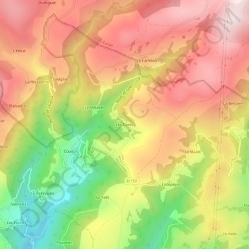
Name: Les Cazes topographic map, elevation, terrain.
Average elevation: 2,431 ft
Minimum elevation: 1,342 ft
Maximum elevation: 3,278 ft
Other topographic maps
Click on a map to view its topography, its elevation and its terrain.
Coudols
France > Occitanie > Aveyron > Viala-du-Tarn
Coudols, Viala-du-Tarn, Millau, Aveyron, Occitanie, France métropolitaine, 12490, France
Average elevation: 2,333 ft
Le Minier
France > Occitanie > Aveyron > Viala-du-Tarn
Le Minier, Viala-du-Tarn, Millau, Aveyron, Occitanie, France métropolitaine, 12490, France
Average elevation: 1,755 ft