Geolocate

Feltre topographic map

Click on the map to display elevation.

About this map

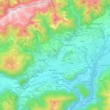
Name: Feltre topographic map, elevation, terrain.

Location: Feltre, Belluno, Veneto, 32032, Italy (45.97198 11.83863 46.12076 11.98720)

Average elevation: 2,470 ft

Minimum elevation: 650 ft

Maximum elevation: 7,566 ft

Gear up for your next adventure:

🥇GPS Hiking Watch - Multi‑sport GPS watch with navigation and trail tracking
🪶Trail Camera - Capture wildlife on your hikes
Backpacking Tents - Weight-optimized shelters for multi-day topographic surveys
📶Vehicle Signal Boosters - Improve reception in rural areas while driving to trailheads
🧯Emergency Survival Kit - All‑in‑one survival essentials for the backcountry

As an Amazon Associate, this site earns from qualifying purchases at no extra cost to you.