
Poblacion 13 topographic map
Interactive map
Click on the map to display elevation.
About this map
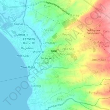
Name: Poblacion 13 topographic map, elevation, terrain.
Location: Poblacion 13, Taal, Batangas, Calabarzon, 4208, Philippines (13.85866 120.90382 13.89866 120.94382)
Average elevation: 125 ft
Minimum elevation: 0 ft
Maximum elevation: 377 ft