
Semmerzake topographic map
Interactive map
Click on the map to display elevation.
About this map
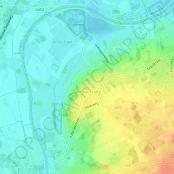
Name: Semmerzake topographic map, elevation, terrain.
Location: Semmerzake, Gavere, Gand, Flandre orientale, Flandre, Belgique (50.93140 3.64772 50.95628 3.68297)
Average elevation: 52 ft
Minimum elevation: 7 ft
Maximum elevation: 144 ft