
Orefield topographic map
Click on the map to display elevation.
About this map
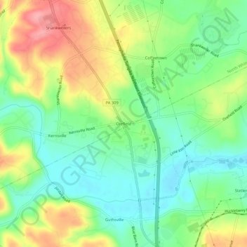
Name: Orefield topographic map, elevation, terrain.
Average elevation: 463 ft
Minimum elevation: 322 ft
Maximum elevation: 679 ft
Lehigh County trails, hiking, mountain biking, running and outdoor activities
Other topographic maps
Click on a map to view its topography, its elevation and its terrain.
Schnecksville
United States > Pennsylvania > Lehigh County > North Whitehall Township
According to the U.S. Census Bureau, Schnecksville has a total area of 2.7 square miles (7.0 km2), of which 0.01 square miles (0.02 km2), or 0.28%, are water. Schnecksville sits on a ridge at an elevation of about 660 feet (200 m) above sea level. To the west, water flows to Jordan Creek, while to the east…
Average elevation: 646 ft