
Cantagallo topographic map
Interactive map
Click on the map to display elevation.
About this map
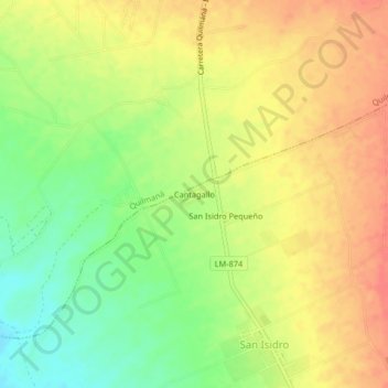
Name: Cantagallo topographic map, elevation, terrain.
Location: Cantagallo, Imperial, Cañete, Lima, 15712, Perú (-13.01535 -76.40546 -12.97535 -76.36546)
Average elevation: 344 ft
Minimum elevation: 240 ft
Maximum elevation: 430 ft
Other topographic maps
Click on a map to view its topography, its elevation and its terrain.
Cerro Alegre
Perú > Lima > Imperial > Cerro Alegre
Cerro Alegre, Imperial, Provincia de Cañete, Lima, 15701, Perú
Average elevation: 404 ft