Geolocate

Rockingham topographic map

Click on the map to display elevation.

Rockingham

Rockingham is topographically flat, has sandy soils and coastal vegetation. It has a northern aspect to Cockburn Sound, from Rockingham Beach and Palm Beach.

About this map

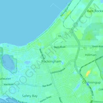
Name: Rockingham topographic map, elevation, terrain.

Location: Rockingham, City Of Rockingham, Western Australia, 6168, Australia (-32.29874 115.71049 -32.26095 115.77697)

Average elevation: 13 ft

Minimum elevation: -20 ft

Maximum elevation: 66 ft

Gear up for your next adventure:

🏥Hiking First Aid Kits - Comprehensive medical kits for remote trail injuries
GPS Sports Watch - GPS watch for running, hiking and training
🥩Freeze-Dried Meals - Nutritious and lightweight food for remote expeditions
📖Nature Tracking Books - Learn to track wildlife and terrain
📚USA Hiking Guide Books - Top trail guides and map books

As an Amazon Associate, this site earns from qualifying purchases at no extra cost to you.