
Parroquia Sucre topographic map
Interactive map
Click on the map to display elevation.
About this map
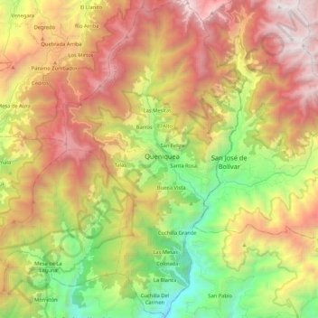
Name: Parroquia Sucre topographic map, elevation, terrain.
Location: Parroquia Sucre, Municipio Sucre, Táchira, 5054, Venezuela (7.81047 -72.08086 8.01900 -71.95899)
Average elevation: 7,215 ft
Minimum elevation: 2,438 ft
Maximum elevation: 12,464 ft