
Thank you for supporting this site ❤️
Make a donation
Make a donation
Gear up for your next adventure:
As an Amazon Associate, this site earns from qualifying purchases at no extra cost to you.
Anif topographic map
Click on the map to display elevation.
Thank you for supporting this site ❤️
Make a donation
Make a donation
Gear up for your next adventure:
As an Amazon Associate, this site earns from qualifying purchases at no extra cost to you.
About this map
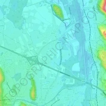
Name: Anif topographic map, elevation, terrain.
Location: Anif, Flachgau, Salzburg, 5081, Austria (47.72298 13.04651 47.76201 13.08290)
Average elevation: 1,453 ft
Minimum elevation: 1,371 ft
Maximum elevation: 1,985 ft
Thank you for supporting this site ❤️
Make a donation
Make a donation
Gear up for your next adventure:
As an Amazon Associate, this site earns from qualifying purchases at no extra cost to you.