Geolocate

Isla Iquitos topographic map

Interactive map

Click on the map to display elevation.

About this map

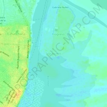
Name: Isla Iquitos topographic map, elevation, terrain.

Location: Isla Iquitos, Belén, Maynas, Loreto, 16001, Perú (-3.75482 -73.25124 -3.71482 -73.21124)

Average elevation: 282 ft

Minimum elevation: 259 ft

Maximum elevation: 341 ft

Other topographic maps

Click on a map to view its topography, its elevation and its terrain.

San Andres

Perú > Loreto > Belén

San Andres, Belén, Maynas, Loreto, 16002, Perú

Average elevation: 292 ft

Amazonas

Perú > Loreto > Belén

Amazonas, Belén, Provincia de Maynas, Loreto, Perú

Average elevation: 289 ft