Geolocate

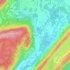
Oak Ridge topographic map

Click on the map to display elevation.

Oak Ridge

Green Pond Mountain, rising to over 1,260 feet (380 m) above sea level, forms the southern border of Oak Ridge and the border with Rockaway Township. Bowling Green Mountain, elevation 1,380 feet (420 m), borders the community to the southwest.

Wikipedia (CC-BY-SA 3.0)

About this map

Name: Oak Ridge topographic map, elevation, terrain.

Location: Oak Ridge, Jefferson Township, Morris County, New Jersey, 07438, United States (40.97982 -74.55564 41.07885 -74.44107)

Average elevation: 1,004 ft

Minimum elevation: 738 ft

Maximum elevation: 1,391 ft

Morris County trails, hiking, mountain biking, running and outdoor activities

Other topographic maps

Click on a map to view its topography, its elevation and its terrain.
Russia

United States > New Jersey > Morris County > Jefferson Township

Average elevation: 1,030 ft

Gear up for your next adventure:

💧Water Purification System - Clean water on the trail with reliable purifiers
🛌Ultralight Sleeping Bags - Compact down bags for cold nights in the wilderness
🎒Outdoor Daypacks - Lightweight backpacks designed for carrying maps and essential gear
🩳Quick‑Dry Hiking Shorts - Comfortable and quick‑dry shorts for summer hiking
🛰️Handheld GPS Units - Professional satellite navigators for precise backcountry mapping

As an Amazon Associate, this site earns from qualifying purchases at no extra cost to you.