
Kangto topographic map
Interactive map
Click on the map to display elevation.
About this map
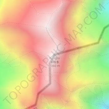
Name: Kangto topographic map, elevation, terrain.
Average elevation: 21,201 ft
Minimum elevation: 18,238 ft
Maximum elevation: 23,071 ft
Other topographic maps
Click on a map to view its topography, its elevation and its terrain.
Lamniya
India > Arunachal Pradesh > Sawa Circle
Lamniya, Sawa Circle, East Kameng district, Arunachal Pradesh, India
Average elevation: 3,602 ft