
Hokuei topographic map
Interactive map
Click on the map to display elevation.
About this map
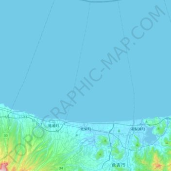
Name: Hokuei topographic map, elevation, terrain.
Location: Hokuei, Tohaku County, Tottori Prefecture, Japan (35.41932 133.67059 35.70337 133.85774)
Average elevation: 102 ft
Minimum elevation: -16 ft
Maximum elevation: 2,697 ft
Other topographic maps
Click on a map to view its topography, its elevation and its terrain.
Kotoura
Kotoura, Tohaku County, Tottori Prefecture, Japan
Average elevation: 348 ft