
Fraga topographic map
Interactive map
Click on the map to display elevation.
About this map
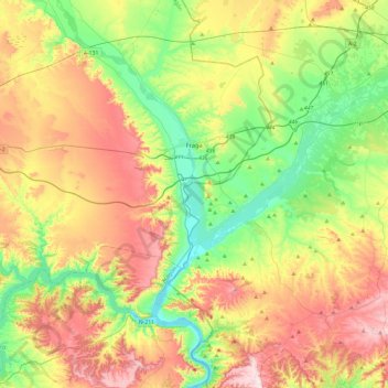
Name: Fraga topographic map, elevation, terrain.
Location: Fraga, Bajo Cinca / Baix Cinca, Huesca, Aragon, 22520, Spain (41.34997 -0.02622 41.60217 0.44728)
Average elevation: 771 ft
Minimum elevation: 213 ft
Maximum elevation: 1,565 ft
Other topographic maps
Click on a map to view its topography, its elevation and its terrain.
Mequinenza
Spain > Aragon > Bajo Cinca / Baix Cinca > Mequinenza
Mequinenza, Bajo Cinca / Baix Cinca, Zaragoza, Aragon, 50170, Spain
Average elevation: 833 ft