Crystal Lake topographic map
Click on the map to display elevation.
About this map
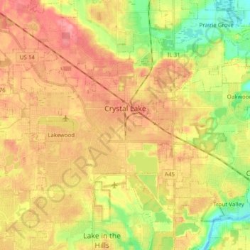
Name: Crystal Lake topographic map, elevation, terrain.
Location: Crystal Lake, McHenry County, Illinois, 60014, United States (42.19006 -88.42330 42.27694 -88.27181)
Average elevation: 876 ft
Minimum elevation: 728 ft
Maximum elevation: 991 ft
McHenry County trails, hiking, mountain biking, running and outdoor activities
Other topographic maps
Click on a map to view its topography, its elevation and its terrain.


Moraine Hills State Park
United States > Illinois > McHenry County > Holiday Hills
Average elevation: 751 ft
Riley
United States > Illinois > McHenry County
Riley, elevation 807 feet (246 m), is an unincorporated community and census-designated place in McHenry County, Illinois, United States. It was named a CDP before the 2020 census, at which time it had a population of 10.
Average elevation: 820 ft