
Jaggan topographic map
Interactive map
Click on the map to display elevation.
About this map
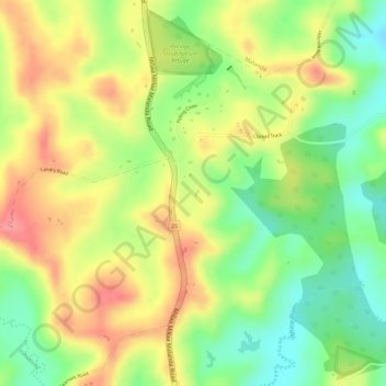
Name: Jaggan topographic map, elevation, terrain.
Location: Jaggan, Malanda, Queensland, Australia (-17.40842 145.58927 -17.38842 145.60927)
Average elevation: 2,490 ft
Minimum elevation: 2,333 ft
Maximum elevation: 2,631 ft
Other topographic maps
Click on a map to view its topography, its elevation and its terrain.
Hillcrest
Australia > Queensland > Malanda
Hillcrest, Malanda, Tablelands Regional, Queensland, Australia
Average elevation: 2,457 ft
Malanda
Australia > Queensland > Malanda
Malanda, Tablelands Regional, Queensland, Australia
Average elevation: 2,441 ft