
Haasrode topographic map
Interactive map
Click on the map to display elevation.
About this map
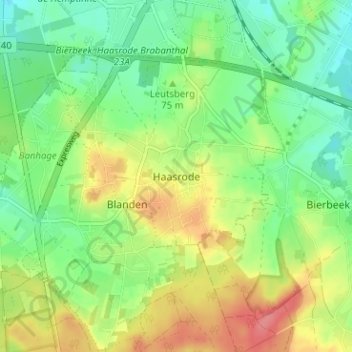
Name: Haasrode topographic map, elevation, terrain.
Location: Haasrode, Oud-Heverlee, Vlaams-Brabant, Vlaanderen, 3053, België (50.81098 4.70704 50.85098 4.74704)
Average elevation: 226 ft
Minimum elevation: 131 ft
Maximum elevation: 361 ft