
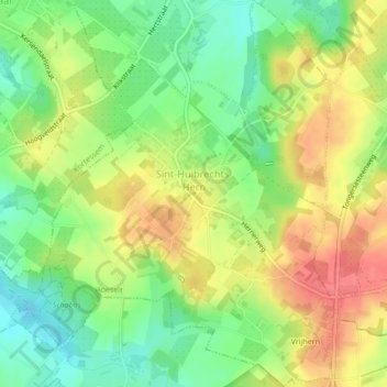
Sint-Huibrechts-Hern topographic map
Interactive map
Click on the map to display elevation.
About this map
Name: Sint-Huibrechts-Hern topographic map, elevation, terrain.
Average elevation: 299 ft
Minimum elevation: 197 ft
Maximum elevation: 407 ft
Sint-Huibrechts-Hern is gelegen in vochtig-Haspengouw. Ten oosten van de kom ligt een bosachtig gebied. De hoogte varieert van 70 tot 112 meter. Zie verder onder Vrijhern.
Other topographic maps
Click on a map to view its topography, its elevation and its terrain.
Alt-Hoeselt
België > Limburg > Tongeren > Hoeselt
Alt-Hoeselt, Hoeselt, Tongeren, Limburg, 3730, België
Average elevation: 279 ft