
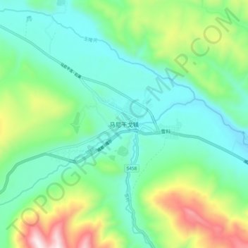
马尼干戈镇 topographic map
Interactive map
Click on the map to display elevation.
About this map
Name: 马尼干戈镇 topographic map, elevation, terrain.
Location: 马尼干戈镇, 德格县, 甘孜藏族自治州, 四川省, 627200, 中国 (31.88767 99.16245 31.96767 99.24245)
Average elevation: 13,317 ft
Minimum elevation: 12,444 ft
Maximum elevation: 15,640 ft
Other topographic maps
Click on a map to view its topography, its elevation and its terrain.