
Avandaro topographic map
Interactive map
Click on the map to display elevation.
About this map
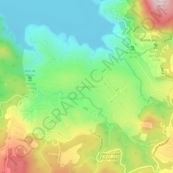
Name: Avandaro topographic map, elevation, terrain.
Location: Avandaro, Valle de Bravo, 51200, México (19.14366 -100.14938 19.18366 -100.10938)
Average elevation: 6,365 ft
Minimum elevation: 5,820 ft
Maximum elevation: 7,254 ft