

Aconcagua topographic map
Click on the map to display elevation.
Aconcagua
Aconcagua (Spanish pronunciation: [akoŋˈkaɣwa]) is a mountain in the Principal Cordillera of the Andes mountain range, in Mendoza Province, Argentina. It is the highest mountain in the Americas, the highest outside Asia, and the highest in the Southern Hemisphere with a summit elevation of 6,961 metres (22,838 ft). It lies 112 kilometres (70 miles) northwest of the provincial capital, the city of Mendoza, about five kilometres (three miles) from San Juan Province, and 15 km (9 mi) from Argentina's border with neighbouring Chile. The mountain is one of the Seven Summits of the seven continents.
About this map
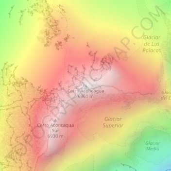
Name: Aconcagua topographic map, elevation, terrain.
Average elevation: 20,344 ft
Minimum elevation: 16,506 ft
Maximum elevation: 22,792 ft