
Esteiro topographic map
Interactive map
Click on the map to display elevation.
About this map
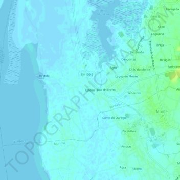
Name: Esteiro topographic map, elevation, terrain.
Location: Esteiro, Bunheiro, Murtosa, Aveiro, 3870-018, Portugal (40.73771 -8.68324 40.77771 -8.64324)
Average elevation: 7 ft
Minimum elevation: -10 ft
Maximum elevation: 46 ft
Other topographic maps
Click on a map to view its topography, its elevation and its terrain.