
Calau topographic map
Interactive map
Click on the map to display elevation.
About this map
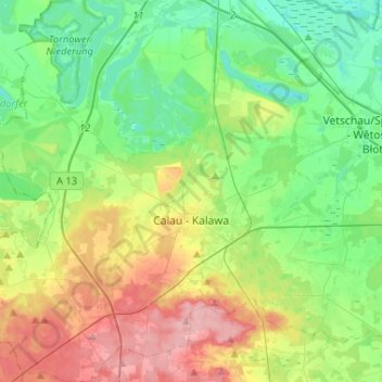
Name: Calau topographic map, elevation, terrain.
Location: Calau, Oberspreewald-Lausitz, Brandebourg, 03205, Allemagne (51.67797 13.79796 51.83925 14.05071)
Average elevation: 272 ft
Minimum elevation: 144 ft
Maximum elevation: 522 ft