
Þórsmörk topographic map
Interactive map
Click on the map to display elevation.
About this map
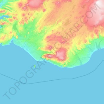
Name: Þórsmörk topographic map, elevation, terrain.
Location: Þórsmörk, Rangárþing eystra, Suðurland, Islande (62.68668 -20.52100 64.68668 -18.52100)
Average elevation: 896 ft
Minimum elevation: -7 ft
Maximum elevation: 6,562 ft
Other topographic maps
Click on a map to view its topography, its elevation and its terrain.