
71590 topographic map
Interactive map
Click on the map to display elevation.
About this map
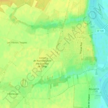
Name: 71590 topographic map, elevation, terrain.
Average elevation: 614 ft
Minimum elevation: 564 ft
Maximum elevation: 643 ft
Other topographic maps
Click on a map to view its topography, its elevation and its terrain.
Mervin
France > Bourgogne-Franche-Comté > Saône-et-Loire > Gergy
Mervin, Gergy, Chalon-sur-Saône, Saône-et-Loire, Bourgogne-Franche-Comté, France métropolitaine, 71590, France
Average elevation: 627 ft
Étang de Ruilly
France > Bourgogne-Franche-Comté > Saône-et-Loire > Gergy
Étang de Ruilly, Gergy, Chalon-sur-Saône, Saône-et-Loire, Bourgogne-Franche-Comté, France métropolitaine, 71590, France
Average elevation: 610 ft