
Neustadt topographic map
Interactive map
Click on the map to display elevation.
About this map
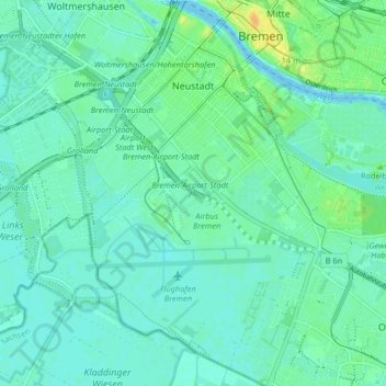
Name: Neustadt topographic map, elevation, terrain.
Location: Neustadt, Stadtbezirk Bremen-Süd, Bremen, Deutschland (53.03133 8.76410 53.08035 8.84112)
Average elevation: 23 ft
Minimum elevation: 0 ft
Maximum elevation: 85 ft
Other topographic maps
Click on a map to view its topography, its elevation and its terrain.
Borgfeld
Deutschland > Bremen > Bremen
Borgfeld, Stadtbezirk Bremen-Ost, Bremen, Deutschland
Average elevation: 13 ft