Geolocate

Sheoganj topographic map

Click on the map to display elevation.

Sheoganj

Sheoganj is located at 25°09′N 73°04′E / 25.15°N 73.07°E / 25.15; 73.07. It has an average elevation of 260 metres (853 feet).

Wikipedia (CC-BY-SA 3.0)

About this map

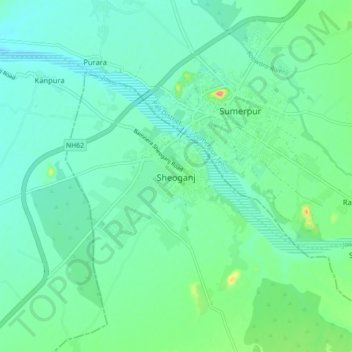
Name: Sheoganj topographic map, elevation, terrain.

Location: Sheoganj, Sheoganj Tehsil, Sirohi District, Rajasthan, 306902, India (25.09889 73.02553 25.17889 73.10553)

Average elevation: 889 ft

Minimum elevation: 820 ft

Maximum elevation: 1,138 ft

Gear up for your next adventure:

🧴Hand Sanitizer - Keep hands clean while hiking
🔭Stargazing Telescopes - Perfect for camping in low-light pollution areas shown on maps
🩳Quick‑Dry Hiking Shorts - Comfortable and quick‑dry shorts for summer hiking
📷Action Cameras - Rugged cameras to document your journeys across rugged terrain
Camping Coffee Makers - Enjoy premium coffee at the summit or campsite

As an Amazon Associate, this site earns from qualifying purchases at no extra cost to you.