
Gemeinde Bruck an der Leitha topographic map
Interactive map
Click on the map to display elevation.
About this map
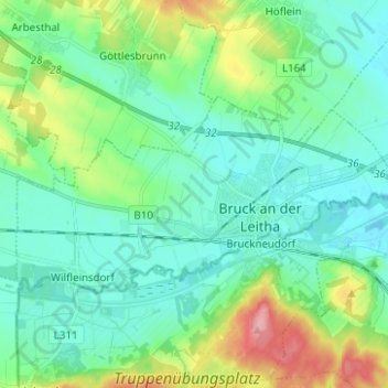
Name: Gemeinde Bruck an der Leitha topographic map, elevation, terrain.
Average elevation: 581 ft
Minimum elevation: 486 ft
Maximum elevation: 879 ft
Other topographic maps
Click on a map to view its topography, its elevation and its terrain.
Gemeinde Petronell-Carnuntum
Austria > Lower Austria > Bezirk Bruck an der Leitha
Gemeinde Petronell-Carnuntum, Bezirk Bruck an der Leitha, Lower Austria, 2404, Austria
Average elevation: 538 ft