
La Petite Île topographic map
Interactive map
Click on the map to display elevation.
About this map
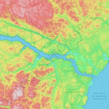
Name: La Petite Île topographic map, elevation, terrain.
Average elevation: 1,152 ft
Minimum elevation: -13 ft
Maximum elevation: 3,314 ft
Other topographic maps
Click on a map to view its topography, its elevation and its terrain.
Sacré-Coeur
Canada > Québec > La Haute-Côte-Nord > Sacré-Coeur
Sacré-Coeur, La Haute-Côte-Nord, Côte-Nord, Québec, G0T 1Y0, Canada
Average elevation: 594 ft