
Monte Sant'Elena topographic map
Interactive map
Click on the map to display elevation.
About this map
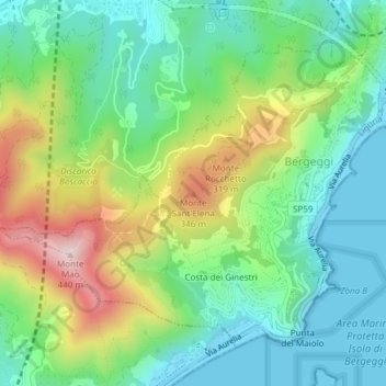
Name: Monte Sant'Elena topographic map, elevation, terrain.
Location: Monte Sant'Elena, Bergeggi, SV, LIG, 17047, Italia (44.24742 8.43202 44.24752 8.43212)
Average elevation: 459 ft
Minimum elevation: -3 ft
Maximum elevation: 1,388 ft