
Toluca topographic map
Click on the map to display elevation.
Toluca
Toluca is located at 2600 meters above sea level, being the highest capital city in Mexico and North America, which makes it temperate throughout the year with average temperatures ranging between 6 and 25 degrees Celsius during spring and summer, and from −5 to 20 degrees Celsius in winter. Its climate is temperate subhumid with rain in summer. Its altitude favors the practice of high-performance sports, but as it is one of the most polluted cities in the country due to the emissions of its industrial corridor and the poor motorized public transportation of the last 3 years, outdoor exercise carries some risks for health.
About this map
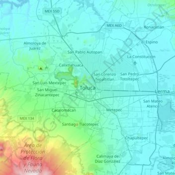
Name: Toluca topographic map, elevation, terrain.
Location: Toluca, State of Mexico, 50000, Mexico (19.13255 -99.81690 19.45255 -99.49690)
Average elevation: 8,953 ft
Minimum elevation: 8,356 ft
Maximum elevation: 13,110 ft
Other topographic maps
Click on a map to view its topography, its elevation and its terrain.