
朝阳区 topographic map
Interactive map
Click on the map to display elevation.
About this map
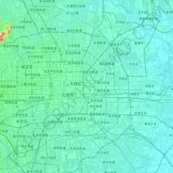
Name: 朝阳区 topographic map, elevation, terrain.
Location: 朝阳区, 朝阳区 / Chaoyang, Pékin, 100010, Chine (39.76045 116.27691 40.08045 116.59691)
Average elevation: 135 ft
Minimum elevation: 59 ft
Maximum elevation: 981 ft
Other topographic maps
Click on a map to view its topography, its elevation and its terrain.