
Neiva topographic map
Interactive map
Click on the map to display elevation.
About this map
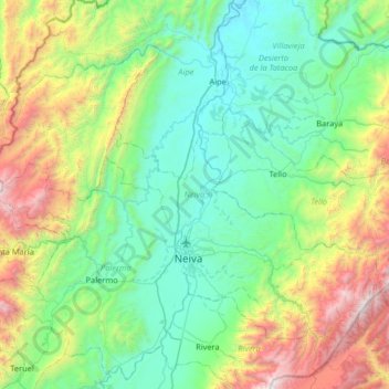
Name: Neiva topographic map, elevation, terrain.
Location: Neiva, Norte, Huila, Colombia (2.78310 -75.62214 3.28342 -74.97082)
Average elevation: 3,386 ft
Minimum elevation: 1,155 ft
Maximum elevation: 10,449 ft