
Fort Parker State Park topographic map
Interactive map
Click on the map to display elevation.
About this map
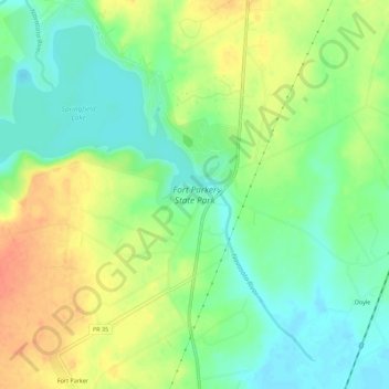
Name: Fort Parker State Park topographic map, elevation, terrain.
Location: Fort Parker State Park, Doyle, Limestone County, Texas, USA (31.56272 -96.56473 31.61068 -96.52302)
Average elevation: 459 ft
Minimum elevation: 394 ft
Maximum elevation: 545 ft