
Tallapalem topographic map
Interactive map
Click on the map to display elevation.
About this map
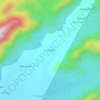
Name: Tallapalem topographic map, elevation, terrain.
Location: Tallapalem, Koyyuru, Andhra Pradesh, India (17.65482 82.21878 17.69482 82.25878)
Average elevation: 1,201 ft
Minimum elevation: 856 ft
Maximum elevation: 2,618 ft
Other topographic maps
Click on a map to view its topography, its elevation and its terrain.
Mallavaram
India > Andhra Pradesh > Koyyuru
Mallavaram, Koyyuru, Alluri Sitharama Raju District, Andhra Pradesh, India
Average elevation: 876 ft