
酉阳县 topographic map
Interactive map
Click on the map to display elevation.
About this map
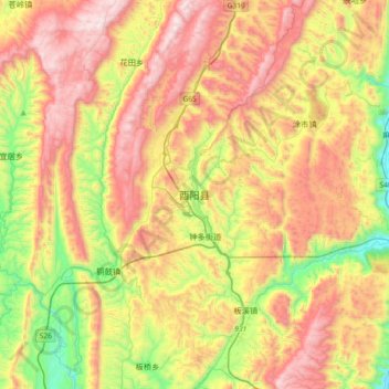
Name: 酉阳县 topographic map, elevation, terrain.
Location: 酉阳县, 桃花源街道, 酉阳土家族苗族自治县, 重庆市, 中国 (28.68441 108.60343 29.00441 108.92343)
Average elevation: 2,999 ft
Minimum elevation: 1,030 ft
Maximum elevation: 5,128 ft