
Archena topographic map
Interactive map
Click on the map to display elevation.
About this map
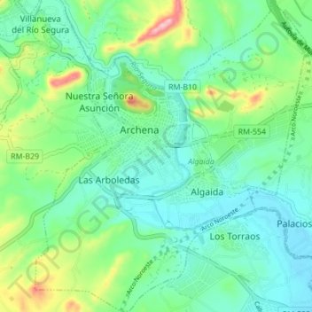
Name: Archena topographic map, elevation, terrain.
Location: Archena, Val-de-Ricote, Région de Murcie, 30600, Espagne (38.08622 -1.32558 38.14029 -1.26566)
Average elevation: 423 ft
Minimum elevation: 259 ft
Maximum elevation: 889 ft