

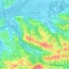
Pau topographic map
Click on the map to display elevation.
Pau
The city, located at an average altitude of 200 metres (660 ft), is crossed by the Gave de Pau, where a ford gave passage to the Pyrenees. Gave is the name given to a torrent in the Pyrenees. The Gave de Pau, which becomes a torrent when mountain snow melts, takes its source in the Cirque de Gavarnie and is the main tributary of the Adour, into which it empties after 175 kilometres (109 mi). The crossing was used for pasturage for sheep in the high meadows. The old route is now a hiking path, GR 65, that runs 60 km (37 mi) south to the border.
About this map
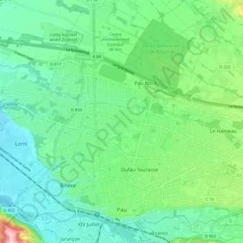
Name: Pau topographic map, elevation, terrain.
Average elevation: 673 ft
Minimum elevation: 522 ft
Maximum elevation: 1,119 ft
Other topographic maps
Click on a map to view its topography, its elevation and its terrain.
Urdazuri
France > Nouvelle-Aquitaine > Pyrénées-Atlantiques > Saint-Jean-de-Luz
Average elevation: 75 ft

Coustères
France > Nouvelle-Aquitaine > Pyrénées-Atlantiques > Salies-de-Béarn
Average elevation: 266 ft


Larroinea
France > Nouvelle-Aquitaine > Pyrénées-Atlantiques > Saint-Jean-Pied-de-Port
Average elevation: 669 ft
Izpegi
France > Nouvelle-Aquitaine > Pyrénées-Atlantiques > Saint-Étienne-de-Baïgorry
Average elevation: 2,073 ft

Château-Observatoire Abbadia
France > Nouvelle-Aquitaine > Pyrénées-Atlantiques > Hendaye > Sopite
Average elevation: 82 ft
Pic d'Orisson / Harburu
France > Nouvelle-Aquitaine > Pyrénées-Atlantiques > Saint-Michel
Average elevation: 2,680 ft

Agerreko Larrea
France > Nouvelle-Aquitaine > Pyrénées-Atlantiques > Mouguerre
Average elevation: 128 ft


Pic d'Orisson / Harburu
France > Nouvelle-Aquitaine > Pyrénées-Atlantiques > Saint-Michel
Average elevation: 2,680 ft