
Lago di Cecita topographic map
Interactive map
Click on the map to display elevation.
About this map
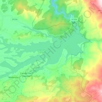
Name: Lago di Cecita topographic map, elevation, terrain.
Location: Lago di Cecita, SP206, Celico, CS, CAL, Italia (39.36109 16.46431 39.40057 16.55308)
Average elevation: 3,944 ft
Minimum elevation: 3,445 ft
Maximum elevation: 4,921 ft