Geolocate

Spring Glen topographic map

Click on the map to display elevation.

About this map
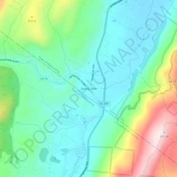
Name: Spring Glen topographic map, elevation, terrain.

Location: Spring Glen, Town of Wawarsing, Ulster County, New York, 12483, United States (41.64565 -74.44988 41.68565 -74.40988)

Average elevation: 751 ft

Minimum elevation: 335 ft

Maximum elevation: 1,778 ft

Ulster County trails, hiking, mountain biking, running and outdoor activities

Gear up for your next adventure:

🧯Emergency Survival Kit - All‑in‑one survival essentials for the backcountry
🚗GPS Dash Cams - Record your scenic drives through mountain passes and canyons
🧼Biodegradable Camping Soap - Eco‑friendly soap for outdoor hygiene
🪶Wildlife Field Guides - Learn animal tracking and species ID
📡GPS Antenna Upgrade - Enhance GPS reception in remote terrain

As an Amazon Associate, this site earns from qualifying purchases at no extra cost to you.