
Finedon CP topographic map
Interactive map
Click on the map to display elevation.
About this map
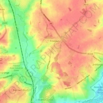
Name: Finedon CP topographic map, elevation, terrain.
Average elevation: 240 ft
Minimum elevation: 108 ft
Maximum elevation: 328 ft
Other topographic maps
Click on a map to view its topography, its elevation and its terrain.
Wellingborough
United Kingdom > England > Wellingborough
Wellingborough, North Northamptonshire, East Midlands, England, NN8 1AF, United Kingdom
Average elevation: 249 ft